Back نهر هارلم Arabic Harlem River Breton Harlem River Catalan Harlem River CEB Harlem River Czech Гарлем (юханшыв) CV Harlem River Danish Harlem River German Rivero Harlem Esperanto Río Harlem Spanish
This article needs additional citations for verification. (November 2010) |
| Harlem River | |
|---|---|
 | |
 The Harlem River, shown in yellow, between the Bronx and Manhattan in New York City. | |
| Location | |
| Country | United States |
| State | New York |
| Municipality | New York City |
| Physical characteristics | |
| Source | Hudson River |
| • coordinates | 40°52′42″N 73°55′33″W / 40.87843°N 73.92594°W |
| Mouth | East River |
• coordinates | 40°46′48″N 73°56′14″W / 40.78003°N 73.93710°W |
| Length | 8 mi (13 km) |
| Basin features | |
| Tributaries | |
| • left | Bronx Kill |
 | |
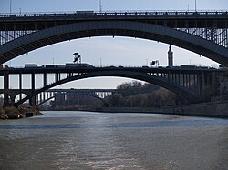
The Harlem River is an 8-mile (13 km) tidal strait in New York City, New York, flowing between the Hudson River and the East River and separating the island of Manhattan from the Bronx on the United States mainland.
The northern stretch, also called the Spuyten Duyvil ("spewing devil") Creek, has been significantly altered for navigation purposes. Originally it curved around the north of Marble Hill, but in 1895 the Harlem Ship Canal was dug between Manhattan and Marble Hill, and in 1914 the original course was filled in.